Heat wave wreaks havoc from Punjab to UP, red alert for heavy rain in Maharashtra, know IMD’s update on weather
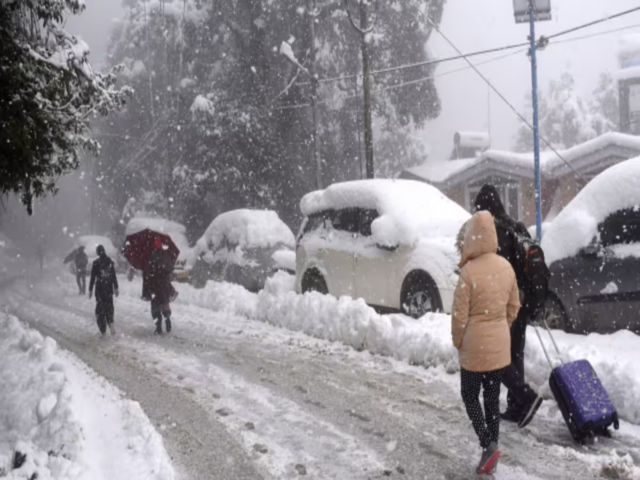
The scorching heat continues to wreak havoc in the northern states of the country. According to the Meteorological Department, the heat wave is expected to continue in different places of Punjab, Haryana, Delhi, Uttar Pradesh, Himachal Pradesh, Uttarakhand, Rajasthan, Madhya Pradesh, Odisha, Bihar and Jharkhand from today i.e. June 10 to June 13. At the same time, monsoon has entered Karnataka, Maharashtra, Arunachal Pradesh, Assam and Meghalaya and an alert of very heavy rain has been issued in these places.
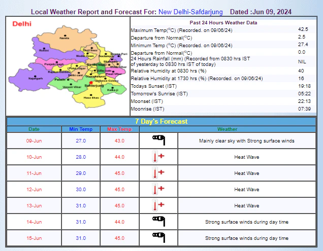
Delhi weather
The Meteorological Department has issued a heatwave alert in Delhi from June 10 to 13. During this period, the period of strong winds will continue. This week, Delhiites may have to face scorching heat and heat wave.
According to IMD, the maximum temperature of Delhi can remain between 44 to 45 degree Celsius and the minimum temperature is likely to remain around 28 to 31 degree Celsius.
Weather condition of the country
According to weather forecast agency Skymet, during the next 24 hours, moderate to heavy rains with very heavy rains at some places may occur in South Konkan Goa, South Madhya Maharashtra and Coastal Karnataka. At the same time, light to moderate rains with heavy rains at some places may occur in Telangana, Marathwada, North Konkan and Goa, North Madhya Maharashtra, Kerala and Andaman and Nicobar Islands.
Apart from this, light to moderate rains are possible in some parts of Sikkim, Northeast India, Lakshadweep, South-West Madhya Pradesh and Vidarbha. Light rains may occur in Odisha, Andhra Pradesh, Tamil Nadu, Chhattisgarh, South Gujarat, Madhya Pradesh and Western Himalayas. At the same time, heat wave conditions are possible in some parts of Madhya Pradesh, Jharkhand, Bihar, Gangetic West Bengal, Odisha, Punjab and Haryana. Heat wave to severe heat wave conditions are possible in different areas of eastern Uttar Pradesh.
Weather activities of the country
According to weather forecasting agency Skymet, the Western Disturbance in the form of a trough in the mid-tropospheric westerly winds, which has a reach of 5.8 km above the mean sea level, is now moving north of latitude 28 degrees North along longitude 70 degrees East. At the same time, a cyclonic circulation remains 1.5 km above the mean sea level in northwest Uttar Pradesh.
Apart from this, another cyclonic circulation is formed in northwest Madhya Pradesh. A cyclonic circulation is formed over Assam. A cyclonic circulation is formed over East Bihar. A cyclonic circulation is formed over Saurashtra and adjoining areas. An offshore trough is formed from Maharashtra to North Kerala. The shear zone is running along latitude 16 degrees North between 3.1 and 7.6 km above the mean sea level.